GPS accuracy is impacting last-mile-delivery service
Ramya Sriram
1 min read
11th Sep, 2023
GNSS applications

As published in Motor Transport, FocalPoint CEO Scott Pomerantz, explains why poor GPS accuracy is impacting last-mile-delivery service
GPS is the most famous of the four Global Navigation Satellite Systems and one of the marvels of the modern world. A GNSS constellation consists of a number of satellites that circle the globe to provide worldwide position, time and velocity information. Since these are low power signals and won’t travel through solid objects, it is normally important to have a clear view of the sky to get an accurate location.
The GNSS market has created $1.4 trillion of benefit to the U.S. private sector since it was made available for civilian use in the 1980s. The annual market is now valued at over €150 billion, through the explosive growth of location-based services offered through smartphones, watches and automotive vehicles. Services like Google Maps, Waze and Uber have become part of our everyday lives and our transport, logistics and financial systems are highly dependent upon these services.

What is the problem with the accuracy of GPS?
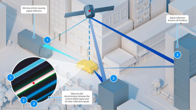
Despite its remarkable capabilities, GNSS does face certain limitations, with one of the most significant challenges being multipath interference. This occurs when satellite signals reflect off buildings, metalwork or other reflective objects before reaching the receiver in your smartphone, watch or automobiles. These reflected signals can cause significant inaccuracies in the measurements, which degrades the overall performance of a position calculation. Performance degrades significantly the more reflective objects that are in the environment in which you find yourself (typical of dense modern cities).
With couriers working daily in the hardest GNSS environments, it becomes almost impossible for companies to know exactly what’s happening as drivers are dispatched. Logistics businesses require systems that function seamlessly in all operational environments, so that end user customers receive the highest-level of customer service.
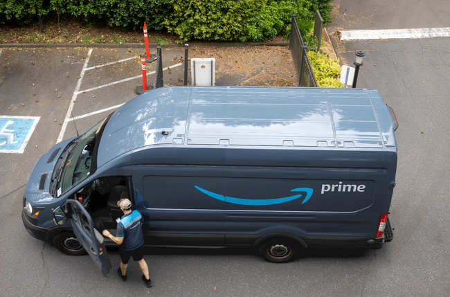
Amazon alone ships 1.6million packages per day (Landing Cube source). Those parcels need to be delivered to the doors of customers, many of which live and work in modern dense urban jungles. Each driver is required to deliver between 250-300 packages a day to over approximately 200 stops. Efficiency is absolutely key to success.
The cost of poor positioning can be substantial. Errors in positioning not only pose safety concerns, but can also result in significant economic consequences from inefficient routing, increased fuel consumption and timely delays impacting delivery schedules, customer satisfaction, and overall profitability.
Current GNSS receivers need to supply higher levels of accuracy, reliability and security across these critical industries and in all environments — suburban, urban and skyscraper jungles!

FocalPoint is solving the urban location problem by dramatically increasing the efficiency, reliability and safety of last mile deliveries. The answer lies in upgrading the way that GNSS receivers interpret satellite signals; a simple but seismic change for this foundational technology. This is achievable through FocalPoint’s Supercorrelation™ software that can be embedded in any GNSS receiver.
Supercorrelation™ is a patented solution that removes all of the GNSS signals that have not come directly from the satellite. This eradicates the multipath and spoofing problem, dramatically improving the performance for smartphones, wearables and automobiles in the deepest of urban environments. FocalPoint is striving to make the logistics solutions of the future more accurate, more reliable and more resilient to cyber attacks.


