


For hands-free driving to be approved in urban areas, ADAS systems must be proven to be reliable. GNSS is part of the problem—but it can also be part of the solution.
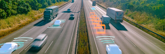
The self-driving future is getting closer, but today, most cruise-control systems can still only be used on open highways. For hands-free driving to be approved for urban areas, a multitude of engineering challenges need to be overcome.
One of those challenges relates to the reliability of the positioning system. OEM’s need to certify that the true position lies within the area described by the estimated position and associated uncertainty with a failure rate small enough so that operations like lane-keeping, lane-changing and manoeuvring are safe.
Sensor accuracy is a key component of ADAS reliability—but sensors are fallible
Achieving continuous, ubiquitous positioning accuracy is a very tall order, however. If you’ve ever used sat nav you’ll know that the position it calculates doesn’t always match up with the vehicle’s real position. That’s especially true in areas where signals from global navigation satellite systems (GNSS) can be disrupted by buildings, tree cover and radio frequency (RF) interference.
Disruption to GNSS can also have an impact on other positioning sensors in the ADAS system. Inertial sensors like accelerometers and gyroscopes must be continually synced with GNSS to stop them drifting. If the GNSS position is wrong, the inertial measurements may be too. And GNSS is far from the only sensor to have issues: cameras, LiDAR and radar can also all be impaired in different ways.
GNSS for ADAS systems: Maximising GNSS receiver reliability
The challenge for ADAS engineers is to develop sensor-based positioning systems that meet future reliability criteria for urban, hands-free driving. Partly, that means building in early warning systems that raise an alert when the system is at risk of being compromised, so a human can take over. The other part is maximising the system’s ability to calculate an accurate and precise position, even in challenging environments.
As GNSS is the only sensor capable of determining the vehicle’s absolute position anywhere on Earth, as well as the sensor typically used to discipline inertial sensors, one engineering priority will be to maximise the reliability of the GNSS receiver.
In practice, that means choosing a GNSS receiver that’s capable of providing a continuous, accurate position in the face of environmental threats like:
Multipath: In built-up areas GNSS signals tend to reflect off buildings, the ground, and other structures around the vehicle. These reflected signals take slightly longer to reach the receiver than line-of-sight signals, and that lag can cause the receiver to miscalculate its position.
Signal attenuation: In areas with overhead tree cover, GNSS signals can be weakened by the filtering effect of foliage. As the signals are already very faint, a layer of foliage can make them too faint for the receiver to distinguish, resulting in intermittent loss of signal lock.
GNSS signal spoofing: Software-defined radio (SDR) has made it relatively easy for malicious actors to broadcast fake GNSS signals. These signals are transmitted at a much higher power than genuine GNSS signals, so an unprotected receiver may lock on to them instead. When this happens, a wildly incorrect position is typically the result—often without warning.
RF interference: Electromagnetic noise in the vehicle’s environment can be another threat to accurate positioning. If the noise is transmitting on or near the frequencies used for GNSS, it can cause the receiver to lose signal lock, or even cause it to calculate an inaccurate position.
A new solution for reliable GNSS-based positioning in difficult environments
Until now, mitigating all of these sources of GNSS receiver impairment was only really possible with some combination of military-grade receivers, redundant sensor arrays, error correction services like RTK, encrypted signals, and adaptive antenna hardware. Without these technologies, GNSS would not be able to meet the level of reliability required for urban hands-free driving.
It’s a problem we’ve been working on for years—and the result is our S-GNSS Auto software solution with Supercorrelation™, which dramatically reduces the cost and complexity of improving GNSS receiver reliability.
By calculating the vehicle’s trajectory and creating a synthetic aperture antenna along that trajectory, Supercorrelation can filter out multipath reflections, spoofed signals and RF noise, to focus only on line of sight signals. It can also give the receiver the equivalent of a 10dB sensitivity boost, improving its ability to maintain lock on attenuated signals. And rather than requiring extra hardware, it runs on the GNSS chip or receiver firmware, making it both unobtrusive and affordable for mass production.
Find out more about S-GNSS Auto with Supercorrelation
While hands-free driving in built-up areas is still some years away, S-GNSS Auto with Supercorrelation can remove several of the engineering barriers to achieving positioning reliability in urban environments. If you’d like to learn more about S-GNSS Auto and Supercorrelation, visit auto.focalpointpositioning.com or get in touch.
Share this post

Ramya Sriram leads marketing at FocalPoint, a UK-based company that provides GPS-enhancing software for automotive, wearables and smartphones.
Related post
Introducing Precise+: High-Precision GNSS in Challenging Environments
Precise+ is FocalPoint's next-generation technology that brings reliable, high-precision positioning to carrier phase measurements, keeping RTK and PPP working even in challenging environments.