


Navigating the modern world with our smartphones and wearables has become second nature, guiding us through unfamiliar streets, aiding our workouts, and keeping us on track in our daily routines. However, despite their ubiquity and convenience, these devices are not without their flaws. You might have experienced the frustration of a poor GPS signal (that confused blue dot on your map) or your fitness tracker/app misreporting the distance of your morning run. These common problems with smartphone and wearable navigation highlight a pressing need for advancements in positioning technology.
In this post, we speak to Matteo Ciprian, Fusion Sensor Engineer at FocalPoint, about how machine learning is being used to improve positioning and navigation for pedestrians, leading to better accuracy, reliability and safety.
What are the common drawbacks of pedestrian navigation systems today?
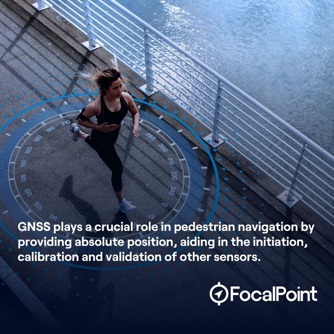
Pedestrian navigation systems typically use a combination of Global Navigation Satellite Systems (GNSS) and dead reckoning techniques based on compass heading and step counting. GNSS accuracy is impacted by a number of factors, including signal interference, reduction or blockage, which impairs precise positioning. Inertial sensors are impacted by drift, which can further complicate how we calculate accurate position. In the low cost sensors used in smartphones and wearables, drift can be dramatic.
As GNSS signals are often weak or unavailable indoors, navigation in large indoor environments like airports and malls can be a challenge. You may have noticed that your smartphone struggles to direct you in these spaces. Currently, there are some solutions in place for indoor navigation, but these solutions often require specialist infrastructure to be installed and maintained.
Advances in sensor fusion and machine learning are part of the solution to addressing these challenges, improving overall accuracy and reliability.
What is a Pedestrian Dead Reckoning system?
Pedestrian Dead Reckoning is a form of inertial navigation that uses inertial sensor data to predict the steps the user is taking and fuses this with the GPS measurements to make position estimates.
Inertial sensors typically include an accelerometer (to measure the acceleration of an object) and a gyroscope (which measures its angular velocity). Sometimes a magnetometer is used, which determines the strength and orientation of Earth’s magnetic field.
What are the disadvantages of PDR?
Pedestrian Dead Reckoning measures the relative position of an object. This means that you need to determine the object’s absolute starting position. A major drawback of this system is its susceptibility to drift errors. Small errors in sensor measurement can compound over time, leading to significant inaccuracies in the calculated position and orientation. The overall accuracy of these systems heavily depend on the quality and sensitivity of the sensors used.
Why is there a need to use GNSS along with inertial sensors?
GNSS is an absolute positioning system with free and global coverage. It offers a stable position over long periods. Unlike inertial sensor measurements, each GNSS position reading is independent of the previous ones, making it useful for correcting drift errors in an Inertial Navigation System (INS).
By integrating INS with GNSS/GPS, the accuracy of positioning improves, as the two systems complement each other and compensate for their individual limitations.
What is sensor fusion and why is it important?
Sensor fusion is an ensemble of techniques that combine information coming from different sources of data in a way that we can extract more information from it. Think of it as rivers of information merging together to provide a better quality of information or a more precise measurement. Our brain is a good example of a fusion engine — or more accurately, multiple fusion engines.
Sensor fusion leverages the power of using multiple sensors or sources of data, tackling common problems, as listed below.
Sensor deprivation: The breakdown of a sensor element causes a loss of perception of the desired object.
Limited spatial coverage: Usually, an individual sensor has a restricted area of coverage
Imprecision: Measurement from an individual sensor depends on the precision of the employed sensing element.
Uncertainty: In contrast to imprecision, uncertainty depends on the object being observed rather than the observing device.
What is the role of machine learning in pedestrian navigation systems?
There are two major ways machine learning is being applied to navigation systems at FocalPoint.
Sensor fusion and machine learning
Machine learning enhances sensor fusion by improving accuracy and precision through advanced pattern recognition and error correction. It adapts in real-time to changing conditions and environments, continuously refining its performance. Machine learning algorithms can effectively handle complex and nonlinear relationships between sensor inputs, providing more robust data fusion. They can also learn from historical data to predict issues, enhancing overall system reliability.
This means that your wearables can deliver consistent performance, providing data that you can trust.
Content aware machine learning
“Context-aware” refers to the system’s ability to recognize and adapt to different user behaviours. This means the system can intelligently adjust its algorithms and processing based on factors like whether the user is walking or running. In the case of a smartphone, the algorithm can recognize whether the user is carrying the phone in their hand or in their pocket. Every human moves in a different way: for example, some might have their phone in their pocket while running, another person might stop and look at their screen every few minutes. By being context-aware, the sensor fusion system can provide more relevant information tailored to the specific situation and activity.

Sensor fusion and machine learning helps wearables provide more accurate data
How is machine learning being used to improve positioning and predict human movement at FocalPoint?
AI has revolutionised how wearable motion sensors like accelerometers and gyroscopes analyse human movement. While traditional methods such as the Kalman Filter are still common, our team is exploring innovative approaches.
Our focus is on developing machine learning models, particularly neural networks, utilising frameworks like LSTM or geometrical deep learning, to derive Human Motion models from extensive datasets collected from athletes and individuals performing various movements.
Our neural network analyses the data and enables precise assessment of motion parameters directly from raw sensor data. This offers intricate insights into human movement dynamics with remarkable precision.
Our Supercorrelation technology uses a combination of machine learning, signal processing and sensor fusion techniques to tackle the challenge of accurate pedestrian navigation. By integrating and analysing data from various sensors, it ensures precise tracking and guidance for individuals, whether they are walking through crowded urban environments, navigating complex indoor spaces, or exploring unfamiliar outdoor areas. This results in enhanced user experiences for applications such as location-based services, augmented reality, and personal safety, ensuring users reach their destinations with confidence and accuracy.
Watch matteo Ciprian in conversation with GNSS Engineer Ross van der Merwe on machine learning and AI in GNSS.
What are some of the applications of navigation systems aided by machine learning?
Improved navigation in challenging environments: Reliable guidance for a pedestrian in urban environments, forests, or spaces where there is reduced GPS signal
Indoor pedestrian navigation and wayfinding: Real-time navigation assistance to guide users through indoor spaces – in our case, without reliance on external technology like WiFi or Bluetooth
Accurate information for emergency services: Enabling emergency services to find pedestrians quicker in the case of accidents or falls, especially in GNSS-denied environments
Interested in learning how machine learning can help accuracy of wearables? Read Matteo’s article on the vital role of GPS accuracy in wearable tech.
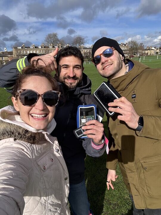
FocalPoint’s Torie Ford, Georgios Voulazeris and Matteo Ciprian collecting data on a winter morning in Parker’s Piece in Cambridge
Share this post

Ramya Sriram leads marketing at FocalPoint, a UK-based company that provides GPS-enhancing software for automotive, wearables and smartphones.
Related post
Navigating the world: Why GPS is essential for safety on our streets
In this post, we’ll explore the powerful impact of GPS on safety in various navigation scenarios, from urban exploration to outdoor hiking, and discuss the challenges that GPS systems still face in providing pinpoint accuracy.