






In this article, our VP of Engineering Steve Mole details how our upcoming technology, Precise+, delivers high-precision positioning in challenging environments.
An introduction to high-precision positioning
Standard GNSS uses the digital ranging signals that GNSS satellites transmit to calculate an absolute position in the world. Standard GNSS is hugely influential – there are trillions of standard GNSS measurements every day in car map displays, cellphones, watches, etc. The accuracy of standard GNSS is limited – in open-sky environments – to about 2 m most of the time. It is degraded in environments where GNSS signals are obstructed: for example, in cities where buildings block the signals or in forests where trees and their leaves obstruct the signal. In these environments, the accuracy of standard GNSS is worse than 2 m: it can be 10 m, 50 m or beyond depending on the environment and other factors.
Instead of the digital signal, high precision GNSS uses the GNSS carrier signal. High precision GNSS Navigation Engines also require additional data from satellites or the internet but the accuracy in open-sky environments can be much improved over standard GNSS – 10cm or better. However, in the same difficult environments that limit the accuracy of standard GNSS, the accuracy of high precision GNSS degrades sharply, often to the same level as standard GNSS. That is, even though high precision GNSS is more accurate than standard GNSS in open-sky environments, it is often no more accurate than standard GNSS in cities or under foliage. This is frustrating for system designers and end-users who pay extra for high precision GNSS but see little or no benefit in some environments. In large cities, it’s not uncommon for a high precision system to spend more than half of a typical drive delivering no better than standard-level accuracy.
How Precise+ works
S-GNSS® Auto, our first product, is built on our patented Supercorrelation® technology and improves code phase and frequency measurements – critical for both standard and high precision positioning. S-GNSS already mitigates the effect of signal obstruction for GNSS receivers and has been demonstrated worldwide. Essentially, in environments where standard GNSS accuracy would degrade, S-GNSS limits or eradicates the degradation so the GNSS accuracy is closer to the ideal, open-sky accuracy.
By accurately modelling the local time standard and the motion of the GNSS antenna through space, S-GNSS enables long coherent integration and – fundamentally – introduces angular sensitivity to the GNSS receiver. Mass-market GNSS devices with single-node GNSS antennas simply receive all the GNSS signal energy that enters the antenna gain pattern. S-GNSS effectively allows the gain pattern to be dynamically modified in software to attenuate signals that have been reflected or diffracted on their journey from the satellite to the receiver.
Precise+ is our new technology that extends the benefits of Supercorrelation to carrier phase measurements, the key to high-precision GNSS receivers. By applying similar techniques but focussing on leveraging the benefits in the tracking of the carrier signal, the sharp accuracy degradation that affects high precision GNSS receivers in difficult environments is significantly reduced and high precision GNSS accuracy extends much further into cities, forests or anywhere where GNSS signals are obstructed.
Just like S-GNSS, Precise+ is easy to integrate. No additional data is required in the GNSS receiver, no changes are required in the system design. The software in the GNSS receiver is updated to take advantage of Supercorrelation and the system accuracy, availability and reliability are all improved.
Impact on accuracy in obstructed environments
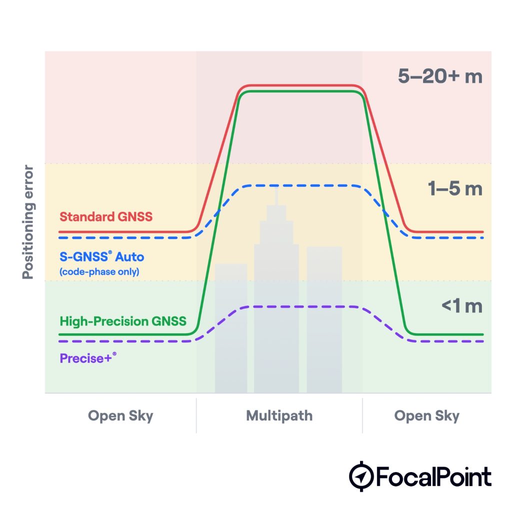
The system accuracy for an existing high precision GNSS receiver and a Precise+ receiver is the same in open-sky environments: these systems operate normally, producing reliable positions of accuracy better than 1 m, when the signals are not obscured.
The system accuracy for an existing standard precision GNSS receiver and an S-GNSS receiver are also the same in open-sky environments: these systems operate normally, producing accuracy of about 2 m when the signals are not obscured.
When these receivers move into urban areas, the performance of all but Precise+ changes. Receivers without Supercorrelation suffer problems caused by the signal obscuration. Existing high precision receivers can no longer produce carrier-phase positions and fall back to the same, degraded accuracy as existing standard precision receivers. An S-GNSS receiver can mitigate the effects of signal obscuration so suffers a small accuracy degradation and continues to produce reliable positions. A Precise+ receiver can mitigate the effects of signal obscuration and continues to produce positions of better than 1 m accuracy.
Benefits of Precise+ for autonomous vehicles
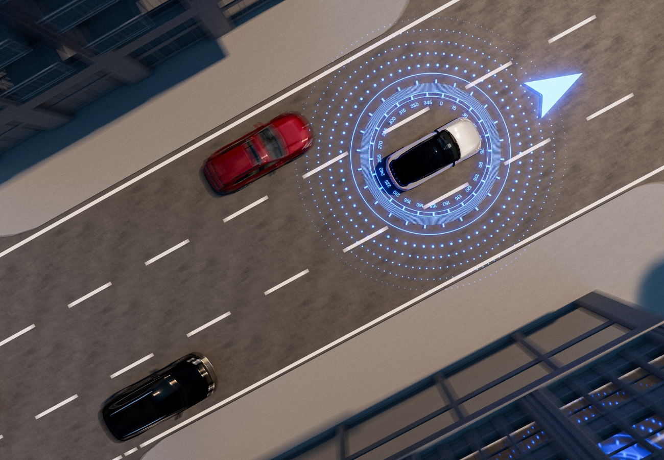
Autonomous and highly automated vehicles define the boundaries to their functionality by specifying exactly how, when and where the system is designed to operate. This is the Operational Design Domain (ODD). These systems often rely on GNSS as a core localisation input. When signals degrade in urban canyons or under tree cover, conventional receivers force the system to fall back to less accurate sources or disengage the automated function entirely. Precise+ maintains reliable GNSS positioning in these environments, extending the ODD into new environments or increasing the system availability in existing environments.
At the system level, GNSS accuracy and availability affect not just lane-level positioning but also the confidence bounds that safety systems use to validate sensor fusion. A Precise+ receiver maintains sub-metre accuracy where a conventional high-precision receiver would fall back to code-phase-only positions of several metres or worse, keeping the GNSS contribution useful rather than a source of uncertainty the rest of the system must compensate for.
The result is an expanded operational envelope for autonomous systems, pushing high-precision GNSS availability into urban and mixed-environment routes where it has historically been least reliable, and where robust localisation is needed most.
Contact us to learn more about Precise+
Share this post

Steve Mole is VP Engineering at FocalPoint. He has over 25 years of experience in GNSS and inertial development. He's previously worked for Broadcom and Intel, focusing mainly on the smartphone industry.
Related post
Webinar: How FocalPoint and ST are delivering reliable GNSS for autonomous driving
FocalPoint and STMicroelectronics present the latest results from testing S-GNSS® Auto on Teseo devices in challenging environments around the world.