


Header image: Imperial College London
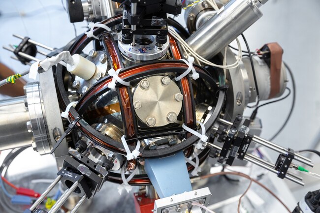
For the last 5 years or so the UK has been working its way through a revival of quantum technologies, driven strongly by hundreds of millions of pounds of funding. The UK has four quantum Hubs, each concentrating on different aspects – computing, encryption, sensing, and imaging. The sensing Hub has been investigating the use of various quantum-based technologies to provide accelerometers and gyroscopes for sensing and navigation purposes. While it is exciting to see new sensors coming into the world with new capabilities, it is critical to maintain a sensible and rational take on the actual applications and capabilities of these technologies. Else we risk under funding, or much worse – cancelling – funding into the other technologies that are actually still required, once you sanity-check your way through the hype associated with quantum tech marketing. On this note, let’s take a look at the news that the UK has unveiled a standalone quantum accelerometer. The coverage across various outlets today seems to suggest that quantum inertial sensors will render SatNav obsolete. Let’s take a look at whether that is true.
Firstly, inertial sensors (even quantum ones) do not fundamentally measure absolute position, they measure changes in position. So whenever inertial sensors are powered up, in order to be useful for navigation purposes they need to be initialised by a different technology, setting up the initial position, pose, and velocity for them. That defacto technology is the humble SatNav. So in the simplest analysis, it is clear that quantum inertial sensors will certainly not render SatNav obsolete, quite the opposite, quantum inertial sensors will be critically dependent upon SatNav if the aim of the game is positioning and navigation. What inertial sensors do do well is bridge the gaps between SatNav outages, or provide dynamic updates at a much higher rate than SatNavs do (e.g. the SatNav component might provide position and velocity information at 10Hz update rate, whereas inertials can fill in the gaps between these updates by working at 100+ Hertz). So inertial sensors and SatNav are highly complementary, but SatNavs can provide positioning and navigation solutions without requiring external help from any other system, but this is not true for inertial navigation, which needs to be initialised with the current position every time it is turned on, by something like a SatNav.
Secondly, all inertial navigation systems suffer drift, even ones with perfect noiseless and biasless sensor measurements. This is due to the fact that once you have removed these error sources from your inertial navigation system error budget, a dozen other things now dominate. These include computational errors (rounding errors, floating point errors, linearisation errors, representability issues, …), initialisation errors, and errors in the inertial navigation system’s gravity model. Accelerometers cannot distinguish gravitational force from dynamic force. So if you have an accelerometer reading 9.82 metres per second squared (mpss), then are you stationary in a place on the Earth where the gravitational field strength is 9.82mpss? Or are you accelerating upwards at 0.01mpss in a locale where the gravitational field strength is 9.81mpss?
It is impossible to know the answer to this from inertial sensing alone. You need to already know your position, and know the expected gravity vector at that location in order to remove the gravity contribution from the accelerometer readings. Your gravity model is very important, and it is impossible to know perfectly. The gravitational field of the Earth is as complicated, and detailed, and un-analytical as the surface of the Earth is. By definition, the stuff in and on the Earth near the sensor is all contributing to that field strength. Park a bus next to a quantum accelerometer and the acceleration reading will change (even though you have not accelerated), because the local gravity field has changed. To put the problem into perspective, gravity at the Equator is 9.78mpss and at the poles it is 9.83mpss. This is not an insignificant difference. So if you take a perfect quantum accelerometer and power it up at the Equator, how will it know if it is actually static at the Equator, or if it is at alternatively the North pole accelerating upwards at 0.05mpss? Or any combination in between? (Hint, the answer is to use a SatNav to tell it where it is…)
Can inertial sensors provide a full positioning solution with no SatNav? Well the only way that this has been achieved in the past is by gravitational map matching, a very expensive and complicated method. You map out the gravitational gradient and strength of the entire planet. You do this by physically going everywhere you want to go, and record data. I’m not exaggerating. You have to go everywhere you might want to in the future be located, and record the gravitational field strength and gradient, and make yourself a map (oh by the way, you use SatNav to do the survey). You still have the initialisation problem however described above – what happens if I’m already accelerating when I turn on the system? I will be located in completely the wrong place, that is what will happen.
So can perfect inertial sensors “render SatNav obsolete”? Nope. Fake News.
Inertial sensors can only ever augment SatNav and other true positioning technologies. It is important that this is understood properly as the roadmaps of quantum sensors, and of the UK GNSS programme evolve, especially as we leave the EU and lose access to the encrypted parts of Galileo. If funding into UK GNSS were to be reduced because of a misunderstanding of the capabilities of quantum-based navigation sensors, that would be a disaster for all navigators, quantum or otherwise.
Share this post

Ramya Sriram leads marketing at FocalPoint, a UK-based company that provides GPS-enhancing software for automotive, wearables and smartphones.